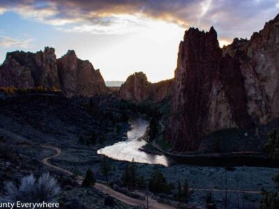
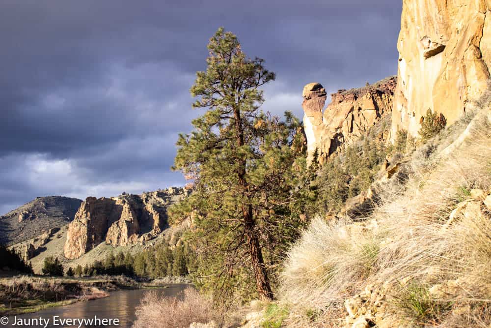
Smith Rock State Park, Terrebonne, Oregon
Smith Rock is a favorite for climbers and hikers in Oregon.
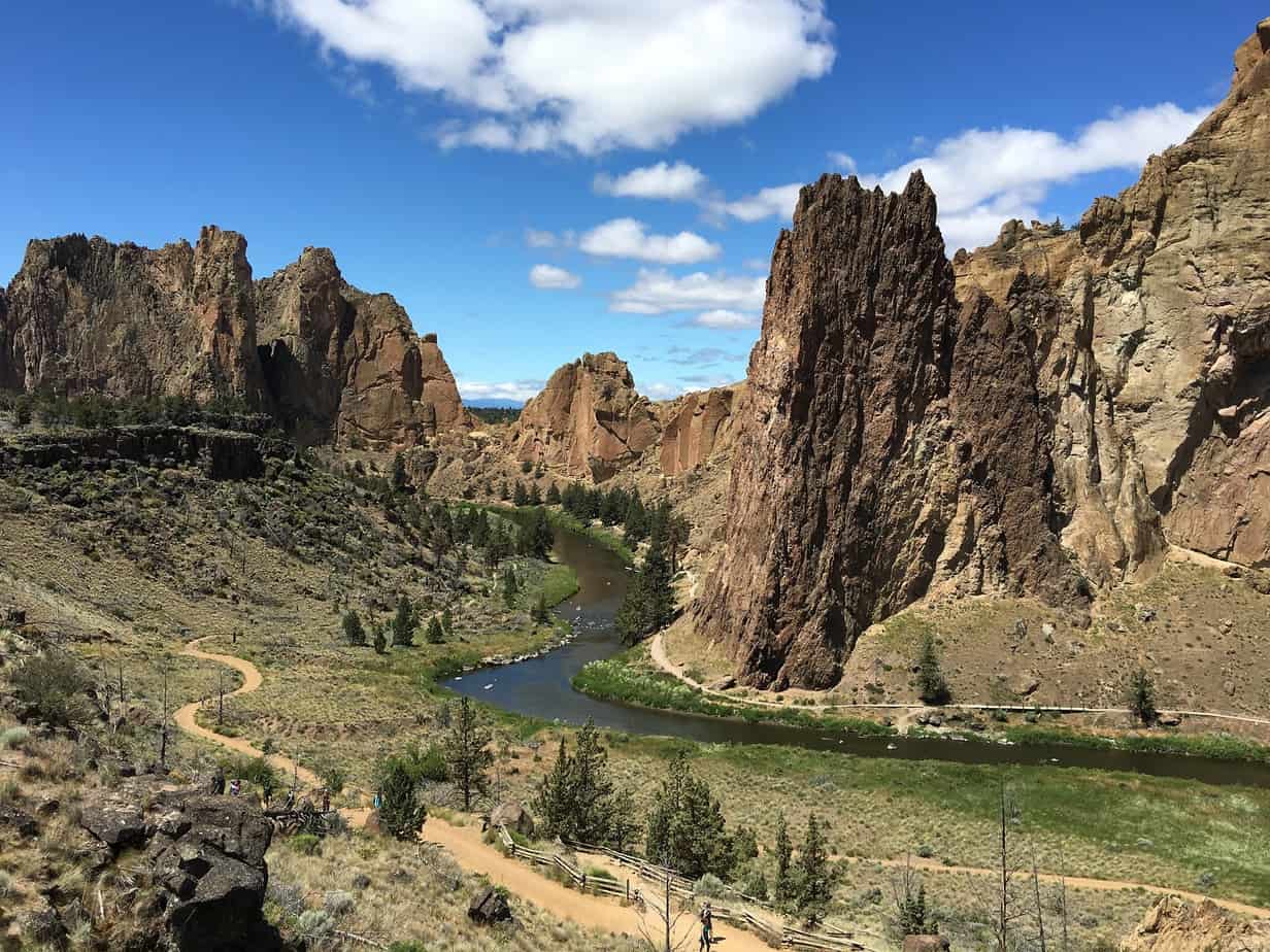
Located in Central Oregon, Smith Rock has a system of trails for all levels. From a seven-mile loop that treks around Smith Rock providing great views of the rock itself, to trails traversing around the base, and a trail climbing up one side and down the other.
With lots of trails to choose from and beautiful views and scenery, this is a wonderful spot to spend a day.
Facts
Where
In Terrebonne, Oregon off of Highway 97.
North of Bend, Oregon.
SmithRock.com has a map of all the trails in the Smith Rock park.
Length
Each trail and trail combinations are different lengths. See the trails below for more information.
Start and endpoint
Here is a map from SmithRock.com including all the trails in the Smith Rock trail system.
Start and end points vary depending on the trail you choose to take. Though most trails will start and end at the parking areas.
Elevation
The elevation at the parking area is 2,841 feet.
From the parking area, the elevation drops about 180ft to the river level.
Each trail covers different elevation gains and losses.
Other access
The Welcome Center is near the main parking area- access to Rim Rock trail, Canyon Trail and trails that connect with all other trails on the map.
Parking area- access to the Rim Rock trail.
Bivouac area is located before the Welcome Center parking area – access to Rope-De-Dope and the Rim Rock trail.
Turn-around parking area- access to North Point trail and Homestead Trail.
Surface
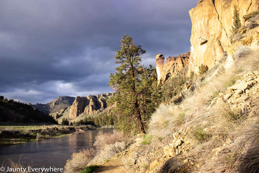
The parking lot is located above the river valley of Smith Rock state park. The walkway leading from the car down to the river alternates between gravel and paved path. The path from the parking area – Canyon Trail – is very steep to start out and eventually levels out once you reach the river level.
The trails around Smith Rock are typically gravel-like or dirt path.
Misery Ridge trail which climbs over Smith Rock is rocky and the trail surface is varied.
Parking
There is parking along the main road near the Welcome Center. There are also two other parking areas, one right before reaching the Welcome Center on the road you drive in on. And another at the end of the road.
Restrooms
There are restroom facilities at the parking area.
There are also outhouses next to ‘The Chute’ trail, and one near the ‘Morning Glory Wall’ on the South end of Smith Rock.

The trails
Find the complete map of trails in the Smith Rock State Park on SmithRock.com.
All the trails can be combined with other trails along the way to add distance or cover a different area of the park. Review the map above to get an idea of which trails connect and how to combine to achieve the trek you want.
Easy
Canyon Trail
Length: 1.6 miles
North Point Trail
Length: approx. 0.5 miles
Rim Rock Trail
Length: 0.7 miles
River Trail
Length: 2.2 miles
Wolf Tree Trail
Length: 1.2 miles
Moderate
Homestead Trail
Length: 0.7 miles
Mesa Verde Trail
Length: 0.7 miles
Rope-De-Dope Trail
Length: 0.4 miles
Summit Trail
Length: 2.2 miles
Difficult
Burma Road Trail
Length: 0.2 miles
Chute Trail
Length: 0.1 miles
Misery Ridge Trail
Length: 4 miles
Why head to Smith Rock?
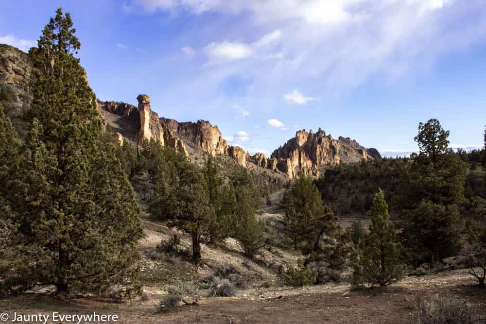
Smith Rock has a rugged beauty that draws you in as you hike around the park. We’ve hiked many of the different trail routes at different times of year and it’s always picturesque.
One adventure included climbing up Misery Ridge from the backside during the winter when everything was covered in snow and super icy. Quite the adventure, and not one I would suggest unless you are prepared with crampons or other winter weather walking equipment.
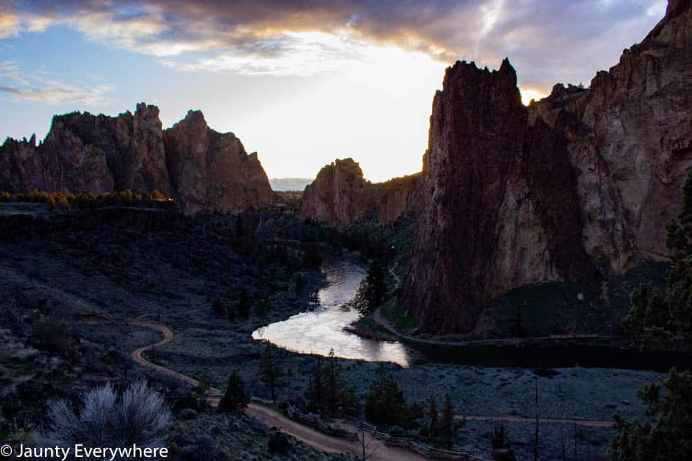
In warmer weather, Misery Ridge is a challenging hike with great views and the perfect spot to watch the sunset.
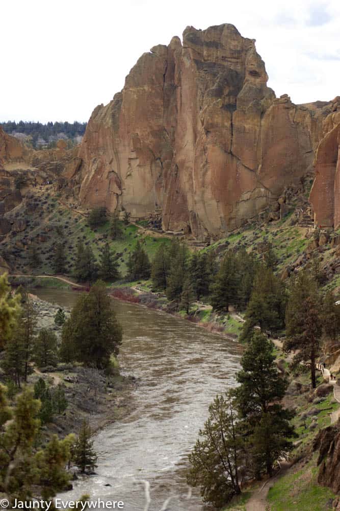
We have also done the Summit Trail which traverses in a wide loop around Smith Rock. This had some incredible views of the surrounding mountains as well as great angles to see Smith Rock as a whole. The Summit Trail starts out at the base of Smith Rock at the entrance and heads north and curves around the west. When you reach the backside you are hiking near the base of the Rock and can look up to see climbers making their way up the variety of routes.
Things to see (aka. photo ops)
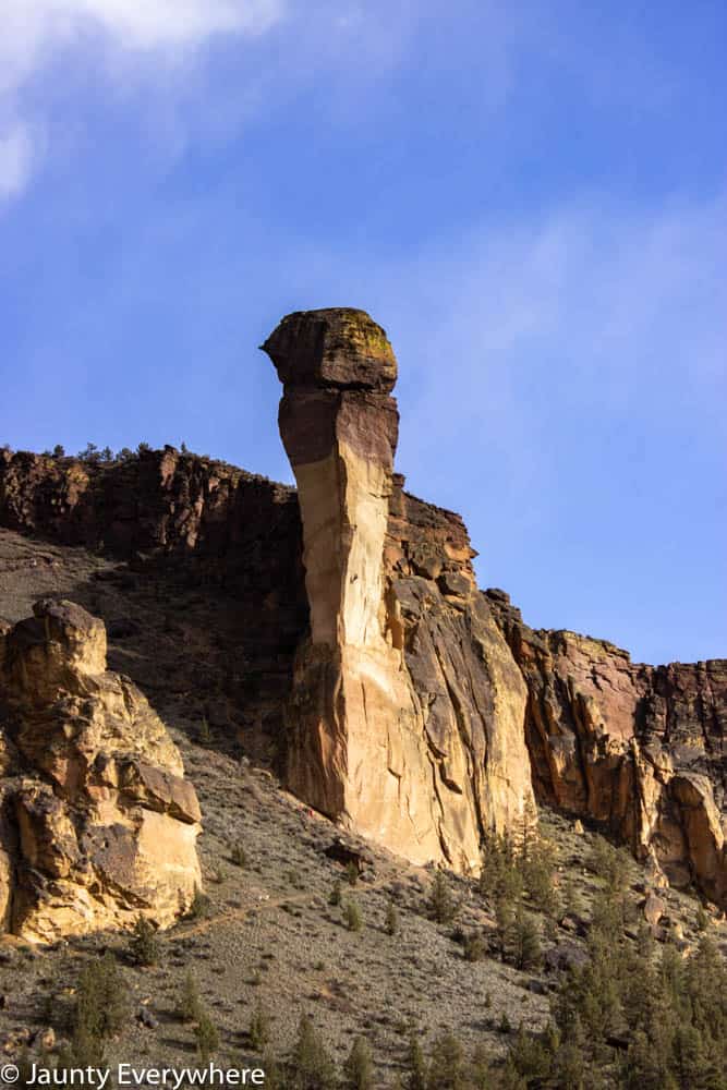
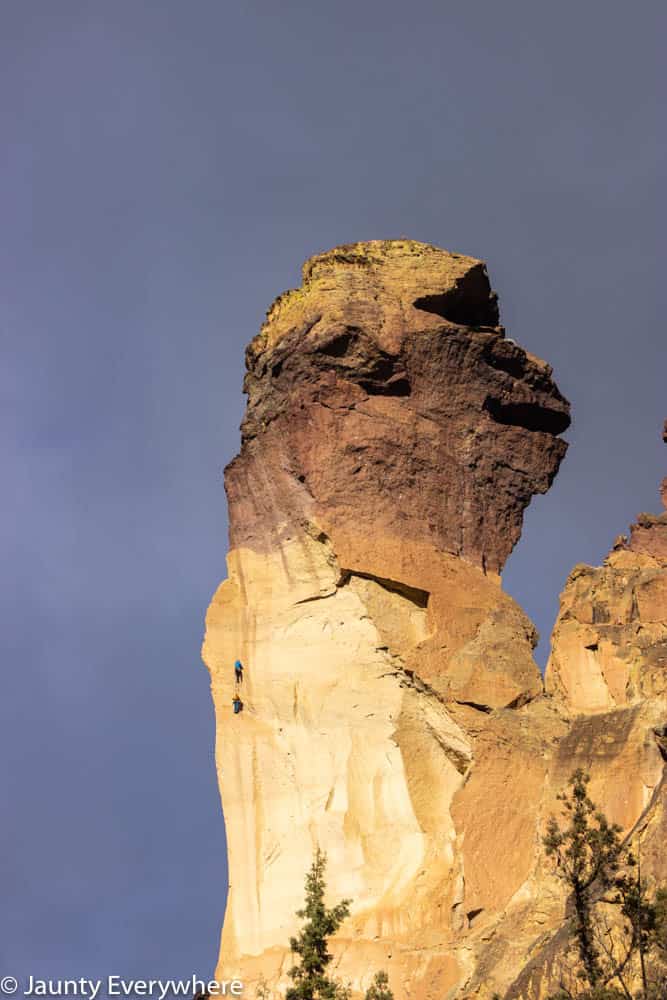
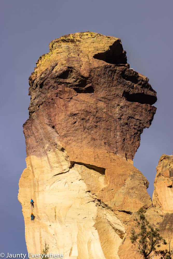
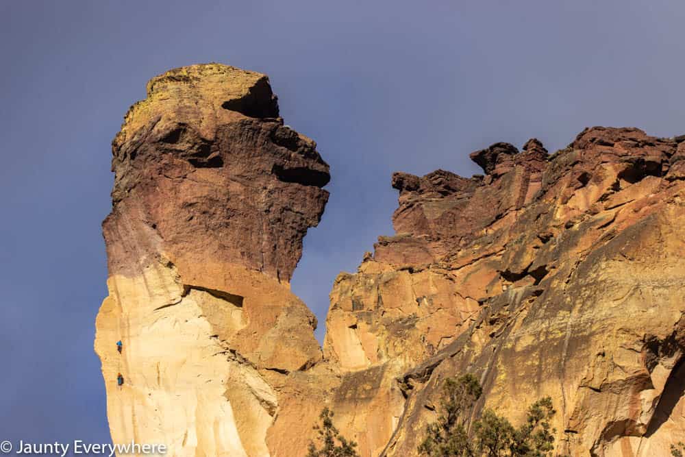
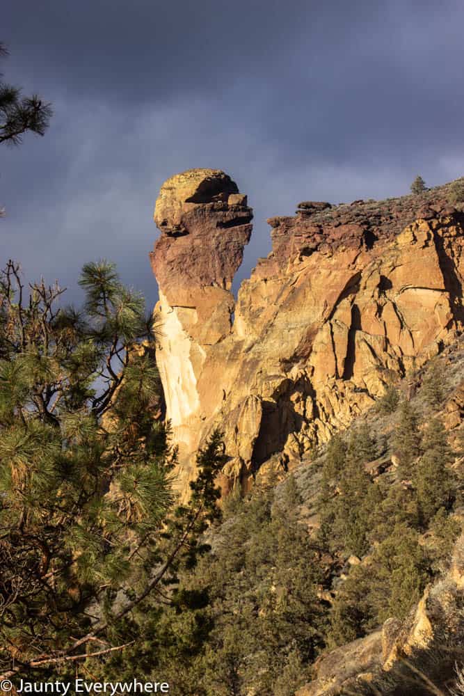
Smith Rock
A stunning site in itself.
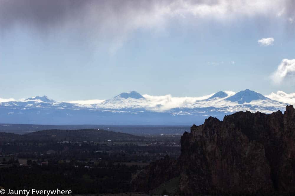
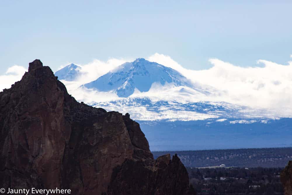
Mt. Jefferson, Three Fingered Jack, Mt. Washington, South Sister, Mt. Bachelor, and Black Butte
All of these are visible from different angles.
The best view of the mountains is probably from Misery Ridge.
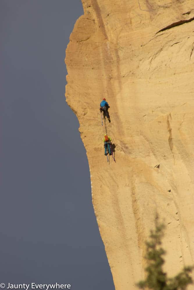
Climbers
Most of the year (when it’s not icy) you will see climbers all over Smith Rock. It’s fun to watch them traverse the rocky sides.
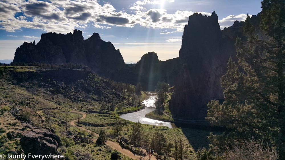
Sunrise or sunset
From the top of Misery Ridge, you can get a great view of Sunset.
Sunrise is not as clear because of a hill nearby, but would still be beautiful to watch.

Make it a day
Smith Rock itself is a full day trip. Between hiking the trails, watching climbers scramble up the steep rock faces, and enjoying the beauty, this location is worth a full day.
Pack a picnic lunch or a trail lunch for convenience. See our post Day Hiking Food for the Trail, and Hiking Snack from Thrive Market for some nutritious, tasty trail foods.
One of our favorite stops after a day at Smith Rock is Terrebonne Depot a restaurant in Terrebonne’s old railroad depot.
Our gallery


More information
Helpful links
Smith Rock info on SmithRock.com
Amazon guidebooks


Other hikes in the Pacific Northwest
Latourell Falls Loop Trail, Columbia River Gorge, OR
Dog Mountain Trail, Columbia River Gorge Area, WA
Elk Mountain and Kings Mountain Loop Trail
Silver Star Mountain Trail, Skamania County, Washington
Tillamook Head Traverse Trail, Oregon
Cottage Grove Covered Bridge Trail – Oregon
If you go to Smith Rock, share a photo with us. Tag us on Instagram @jauntyeverywhere or use #jauntyeveryday.